served from IRI/LDEO Climate Data Library
∫dY ∂Y ∫dX [ IGOSS TOPEX NOAA ssha ] : ∂Y Sea Surface Height Anomaly data
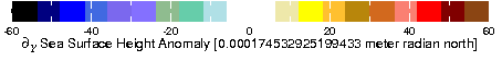
ssha ssha int_dX partial_Y partial_Y partial_Y ∂Y Sea Surface Height Anomaly from IGOSS TOPEX NOAA: NOAA TOPEX/POSEIDON Altimeter Gridded Sea Level Analysis.Independent Variables (Grids)
- Time (time)
- grid: /T (months since 1960-01-01) ordered (Nov 1992) to (Jun 2002) by 1.0 N= 116 pts :grid
- Longitude (longitude)
- grid: /X (degree_east) ordered (0) to (0) by 4.0 N= 91 pts :grid
- Latitude (latitude)
- grid: /Y (degree_north) ordered (59.5S) to (59.5N) by 1.0 N= 120 pts :grid
Other Info
- bufferwordsize
- 8
- CE
- 60
- CS
- -60
- datatype
- doublearraytype
- missing_value
- NaN
- units
- 0.000174532925199433 meter radian north
- history
- $integral dY$ $partialdiff sub Y$ $integral dX$ [ IGOSS TOPEX NOAA ssha ]
- Monthly mean sea surface height anomaly. USA
- colorscale
References
Cheney_etal1994Last updated: Fri, 18 Sep 2015 18:39:07 GMT
Data Views
Filters
Here are some filters that are useful for manipulating data. There are actually many more available, but they have to be entered manually. See Ingrid Function Documentation for more information.- Monthly Climatology calculates a monthly climatology by averaging over all years.
- anomalies calculates the difference between the (above) monthly climatology and the original data.
- Integrate along X Y T
- Differentiate along X Y T
- Take differences along X Y T
RMS (root mean square with mean *not* removed) over X Y T | X Y X T Y T | X Y T |
RMSA (root mean square with mean removed) over X Y T | X Y X T Y T | X Y T |
Maximum over X Y T | X Y X T Y T | X Y T |
Minimum over X Y T | X Y X T Y T | X Y T |
Detrend (best-fit-line) over X Y T | X Y X T Y T | X Y T |
Note on units